


Table of contents
- Understanding GIS and Remote Sensing: Applications and Benefits
- What is GIS?
- What is Remote sensing?
- What is the difference between GIS and remote sensing?
- Why are GIS and remote sensing important?
- Application of GIS and remote sensing
- GIS and Remote Sensing in Transportation Management
- GIS and Remote Sensing in Urban Planning
- GIS and Remote Sensing in Disaster Management
- GIS and Remote Sensing in Agriculture
- GIS and Remote Sensing in Ecosystem Management
- GIS and Remote Sensing in Ecosystem Fisheries
- GIS and Remote Sensing in Ecosystem Healthcare
- GIS and Remote Sensing in Military Operations
- FAQ
Understanding GIS and Remote Sensing: Applications and Benefits
Geographic Information Systems (GIS) and Remote Sensing are transformative technologies that provide critical insights into the Earth's surface and features. GIS allows for the capture, analysis, and visualization of spatial data, enabling users to explore and understand geographic patterns and relationships. Remote Sensing complements GIS by gathering data from aerial or satellite imagery, which is then used for a wide range of applications including urban planning, disaster management, agriculture, ecosystem management, and more.
At Barsi, we integrate GIS and Remote Sensing technologies to enhance decision-making and support sustainable development strategies, offering a comprehensive view of both natural and built environments as a leading GIS solutions company.
What is GIS?

Geographic Information Systems (GIS) are computer systems that capture and analyze data tied to locations on Earth. They allow you to see, understand, and explore patterns by layering data on maps. Imagine a map with buildings, streets, and vegetation - GIS helps you see how these features interact.
GIS is powerful because it can combine many data types. This can include people (population, income, education) or the environment (soil, plants, water). It can even map infrastructure like factories, farms, schools, roads, and power lines. By looking at all this data together, GIS helps you see hidden connections.
For instance, you could use GIS to find factories that emit pollution and see if they are near wetlands. This could help you understand where pollution might be most harmful to water supplies. GIS combines databases and maps to create dynamic visuals and deep analysis. This makes GIS a valuable tool for businesses to understand situations, predict what will happen, and make better plans.
How does GIS work step by step?

GIS operates through 5 essential steps:
- Collecting Data - In GIS, the first step is all about gathering information about a location. This data is collected from tools like GPS, satellites, and surveys. The data typically appears as maps, satellite images, and other geographic formats.
- Storing and Organizing Data - This involves saving GIS data in a database or file system. The data can be organized, maintained, and modified as needed. Users can edit, filter, and adjust the data to meet specific requirements.
- Analyzing Data - GIS tools examine the data through spatial queries, map overlays, and 3D modeling. These techniques help uncover patterns, trends, and relationships in the data.
- Visualizing Data - GIS software converts data into visual formats like maps, charts, and graphs. This makes the data easier to understand and interpret.
- Making Informed Decisions - Insights gained from GIS analysis support decision-making processes. These insights are crucial for urban planning, environmental and agricultural monitoring, and disaster responses.
What are the 5 components of GIS?

GIS consists of five main components: data, software, hardware, methods, and people.
- Data is the foundation of GIS. It includes spatial data like maps, satellite imagery, GPS data, and surveys. Spatial data is stored in formats allowing integration and analysis. There are three types: vector data, raster data, and tabular data.
- Software is essential for GIS operations. It collects, analyzes, stores, and visualizes spatial and attribute data. GIS software is used in various fields such as urban planning, disaster response, and fleet management. It provides interfaces for loading, displaying, and analyzing geographic data, and creating maps.
- Hardware supports GIS software. It includes desktop computers, scanners, GPS devices, printers, servers, and mobile devices. These components help in manipulating and displaying geographic data.
- Methods used in GIS include spatial analysis, cartography, remote sensing, geostatistics, network analysis, data visualization, data management, and 3D modeling. These methods enable the analysis and presentation of geographic data in informative ways.
- People are crucial in GIS. Professionals design projects, collect and manage data, perform analyses, create visualizations, and communicate results to stakeholders. They ensure the effective use of GIS technology.
What is Remote sensing?

Remote sensing is the science of obtaining the physical properties of an area without direct contact. Specialized platforms, such as airplanes, satellites, and UAVs, bear sensors that gather imagery for various analyses, including land cover classification.
Remote sensing works by measuring electromagnetic waves emitted or reflected from Earth. This method detects and monitors the physical characteristics of an area using aircraft-based and satellite-based sensors, which are either passive or active.
In essence, remote sensing measures radiation from a distance using special cameras, satellites, and aircraft. This technology replaces manual ground data collection, offering a comprehensive view of the physical characteristics of different areas.
What are remote sensing types?

Remote sensing involves two types of sensors: passive and active.
- Active remote sensing
Active sensors emit energy to scan objects and areas, measuring the reflected energy to collect data. They use internal stimuli and illuminate their targets.
- Passive remote sensing
Passive sensors capture reflected sunlight or emitted radiation from external sources. They measure radiation reflected from the Earth’s surface. Common passive sensors include charge-coupled devices, film photography, radiometers, and infrared sensors.
Both types are crucial for gathering data about the Earth's surface and atmosphere.
What is the difference between GIS and remote sensing?

Remote sensing and GIS (Geographic Information System) serve different but complementary roles in data collection and analysis. Remote sensing is a technique used to gather data about an object or area from a distance, typically through satellite or aerial imagery. It involves complex interfaces and requires skilled personnel for interpretation. Remote sensing captures raw data, which is essential for subsequent analysis.
In contrast, GIS is a computer system designed to analyze and interpret this collected data. It combines software and hardware to manage, analyze, and visualize geographic information. GIS can handle vast datasets, transforming raw data from remote sensing and other sources into meaningful insights. Unlike remote sensing, GIS features a more user-friendly interface, enabling users to interpret data without extensive technical expertise.
Furthermore, GIS is highly efficient, allowing a single user to analyze large datasets quickly and cost-effectively. It supports various data types, including spreadsheets and vector data, and allows unlimited edits without risking system stability. Remote sensing data, however, is specific to the area examined and is also more prone to damage.
Why are GIS and remote sensing important?

The importance of GIS and remote sensing lies in their integrated ability to provide essential information on the spatial variation, extent, and potential of natural resources. This integration is crucial for planning sustainable development strategies. They work together to generate valuable data on ecosystem functioning, soil characterization, surface water, groundwater, and land use/land cover (LULC) mapping. Remote sensing, with its capacity for continuous and cost-effective monitoring via spaceborne sensors, enables the collection of data from vast and often inaccessible areas.
GIS complements remote sensing by providing a framework for integrating spatial and attribute data, which supports various applications such as hydrological and ecological modeling. It plays a significant role in the planning and management of natural resources and decision-making processes. The importance of GIS and remote sensing extends to sustainable development planning, preserving natural and cultural heritage, urban planning, and enhancing public participation.
Together, these technologies offer reliable tools for analysis, management, problem-solving, planning, policymaking, and decision-making, all essential for achieving sustainability goals.
Application of GIS and remote sensing
Emerging technologies in GIS and remote sensing are revolutionizing various fields by providing crucial spatial data and analysis. These tools offer innovative solutions for planning, monitoring, and decision-making in various areas. Let’s explore some uses of gis and remote sensing:
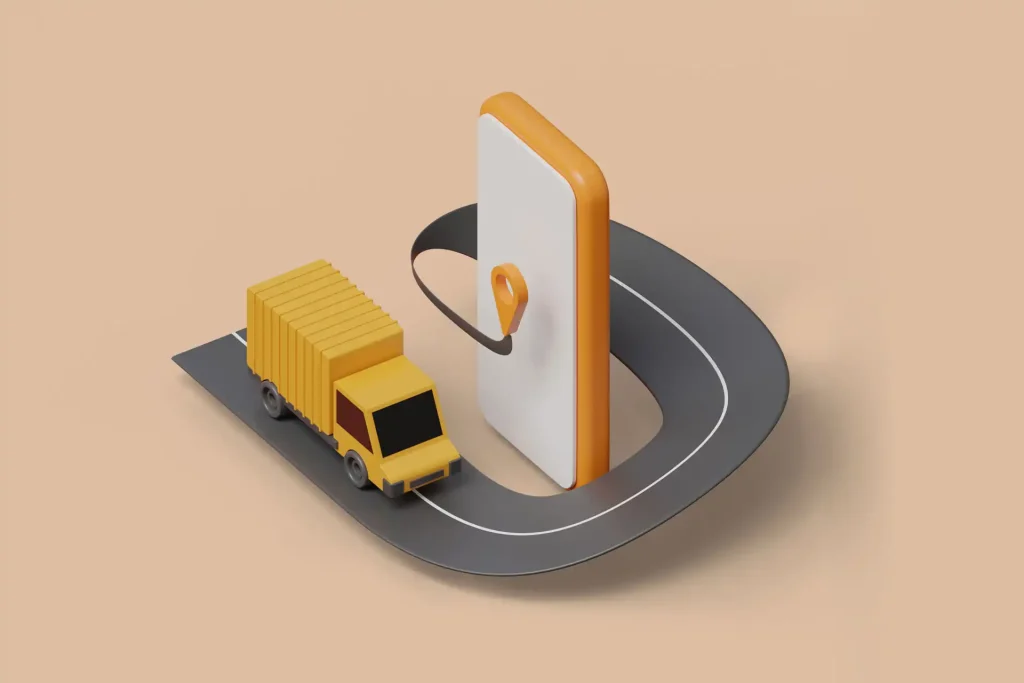
GIS and Remote Sensing in Transportation Management

GIS and remote sensing are crucial for transportation management, offering innovative solutions across various aspects. These technologies facilitate planning, environmental impact assessment, hazard and disaster response, infrastructure management, and traffic assessment. They provide real-time data collection from satellites, aircraft, and ground platforms, allowing for timely and accurate monitoring of roadways, bridges, and traffic flows. Remote sensing helps in detecting changes in transportation systems, supporting corridor and project management, and ensuring safety and security planning. The integration with GIS enables efficient data manipulation, visualization, and decision-making, leading to cost-effective and precise transportation management. Emerging technologies like hyperspectral remote sensing and LIDAR further enhance capabilities, providing detailed analysis and improved accuracy.
GIS and Remote Sensing in Urban Planning

GIS and remote sensing are essential in urban planning for collecting and analyzing urban data, monitoring city growth patterns, and informing policies and building regulations. These technologies provide comprehensive data on residential land use, density, and infrastructure needs, aiding in urban planning and design. They help propose new roads, public transportation, and green spaces while ensuring efficient water and waste management. Additionally, GIS and remote sensing facilitate the study of various housing types, slum rehabilitation, and policy improvements. They also aid in identifying illegal developments, detecting urban climate issues, and planning public services, making them vital tools for sustainable urban development.
GIS and Remote Sensing in Disaster Management

GIS and remote sensing play a crucial role in disaster management by providing precise spatial data on past disasters, enabling visualization of vulnerabilities and damages. These technologies assist in hazard zone mapping, emergency operations, and decision-making processes. GIS and remote sensing are essential for creating mitigation strategies and preparedness plans, as they offer real-time geographic data that improve resource allocation for disaster response. Additionally, they aid in modeling disaster risks and human adaptations to hazards, supporting a comprehensive decision support system for disaster management.
GIS and Remote Sensing in Agriculture

GIS and remote sensing play a pivotal role in agriculture by providing essential data for crop inventory, yield analysis, and resource management. These technologies help identify crop types, monitor changes in cropping patterns, and create crop-specific maps by combining satellite imagery with survey data. This data aids agri-businesses in decision-making and resource allocation. Remote sensing is crucial for assessing crop health, predicting yields, and managing nutrient and water stress, using vegetation indices and spectral reflectance measurements. Additionally, it supports flood monitoring and forecasting by analyzing hydrological data and surface water dynamics. GIS and remote sensing also facilitate land use and cover mapping, pest infestation detection, and water resource management, enhancing the precision and efficiency of agricultural practices and ensuring sustainable resource use.
GIS and Remote Sensing in Ecosystem Management

GIS and remote sensing are essential in ecosystem management, providing tools to evaluate and understand changing environments. These technologies help link environmental effects with physical parameters, aiding in implementing management strategies. GIS technology enables resource managers to make informed decisions by predicting critical areas for species and displaying habitats of keystone or indicator species. These technologies support the shift towards large-scale ecological assessments by automating, managing, and analyzing spatial data. Additionally, GIS integrates social and economic factors, enhancing the comprehensive analysis required for effective ecosystem management.
GIS and Remote Sensing in Ecosystem Fisheries

GIS and remote sensing play a transformative role in fisheries by enhancing the understanding of oceanic ecosystems and informing management and conservation efforts. These technologies allow researchers and policymakers to visualize and analyze complex relationships between ecological variables, human activities, and fishery resources. This spatial understanding improves the precision of management strategies, leading to optimized resource allocation and effective conservation measures. The data generated empower stakeholders to make informed decisions, promote sustainable practices, and mitigate the impact of human activities on marine ecosystems, balancing population needs with sea quality preservation for future generations.
GIS and Remote Sensing in Ecosystem Healthcare

The integration of remote sensing and GIS in healthcare provides a powerful toolset for analyzing and addressing health-related issues. Remote sensing captures real-time environmental data, such as pollution levels, land use, and temperature variations, which can be integrated into GIS for spatial analysis. This combination allows healthcare professionals to identify high-risk areas and plan targeted interventions. Remote sensing data, like satellite images of vegetation and land cover, help understand disease vectors' habitats and predict outbreaks, crucial for controlling vector-borne diseases. During natural disasters or public health emergencies, Remote sensing provides real-time information on affected areas, enabling efficient deployment of healthcare resources. Case studies highlight how remote sensing and GIS integration has been used for predicting malaria outbreaks and assessing telehealth service accessibility in urban planning, ensuring equitable healthcare distribution.
GIS and Remote Sensing in Military Operations

GIS and remote sensing are crucial in military operations due to their ability to provide reliable and accurate spatial mapping. These technologies support Command, Control, Communication, and Coordination by offering high-resolution satellite data and drone technology, integrated with machine learning and AI. Applications include cartography, terrain analysis, intelligence collection, object recognition, and protection of vital installations. They enhance military planning and deployment by enabling real-time understanding of landscapes and strategic positions.
FAQ
What does GIS stand for?
GIS stands for Geographic Information Systems, which are tools for gathering and analyzing data related to geographic locations and their connection to human or natural activities on Earth.
Is Google Maps a GIS?
Google Maps is considered a GIS by some professionals because it analyzes geographic data and maps landmarks and features. However, others disagree, citing its lack of detailed topographic database connections and comprehensive geographic feature mapping.
Is a GPS a GIS?
No, a GPS is not a GIS. GPS provides location information, while GIS organizes, analyzes, and visualizes geographic data.
Is GIS a software?
GIS is not just a software; it is a system that includes software tools for gathering, analyzing, and visualizing geographic data, integrating hardware, software, data, and people to understand spatial relationships and patterns.
Who is the father of GIS?
Roger Tomlinson, often referred to as the “Father of GIS,” developed the Canada Geographic Information System in the early 1960s, widely regarded as the first serious GIS.
What is the difference between GNSS and GIS?
GNSS (Global Navigation Satellite Systems) provides precise location information, while GIS (Geographic Information Systems) maps and analyzes geospatial data.
Is GIS a tool or science?
GIS is both a tool and a science. It encompasses software tools for mapping and analyzing geographic data, and the scientific principles and methods for understanding spatial patterns and relationships.
How old is GIS?
GIS has been in development since the early 1960s, making it over 60 years old. The first serious GIS, the Canada Geographic Information System, was developed in the early 1960s by Roger Tomlinson.
Does NASA use GIS?
Yes, NASA uses GIS extensively for analyzing and visualizing spatial data. GIS helps NASA in mapping, environmental monitoring, disaster response, and studying planetary surfaces, thereby enhancing their understanding of Earth and other celestial bodies.


